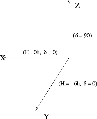
To compute the (![]() ) co-ordinates of the antennas, the antenna
locations must first be specified in a terrestrial co-ordinate system.
The terrestrial coordinate system generally used to specify the
position of the antennas is a right-handed Cartesian coordinate system
as shown in Figure 10.2. The (
) co-ordinates of the antennas, the antenna
locations must first be specified in a terrestrial co-ordinate system.
The terrestrial coordinate system generally used to specify the
position of the antennas is a right-handed Cartesian coordinate system
as shown in Figure 10.2. The (![]() ) plane is parallel
to the earth's equator with
) plane is parallel
to the earth's equator with ![]() in the meridian plane and
in the meridian plane and ![]() towards
east.
towards
east. ![]() points towards the north celestial pole. In terms of the
astronomical coordinate system (
points towards the north celestial pole. In terms of the
astronomical coordinate system (![]() ),
), ![]() ,
, ![]() and
and
![]() . If the components of
. If the components of
![]() are
are
![]() , then the components in the
(
, then the components in the
(![]() ) system can be expressed as
) system can be expressed as
![\begin{displaymath}
\left[\matrix{
u\cr
v\cr
w\cr
}\right]=\left[\matrix{
sin(H...
...sin(\delta)\cr
}\right]\left[\matrix{
X\cr
Y\cr
Z\cr
}\right].
\end{displaymath}](img995.gif) |
(10.1.6) |
| (10.1.7) |
The ![]() domain is the spatial frequency domain and
domain is the spatial frequency domain and ![]() -coverage
represent the spatial frequencies sampled by the array. The shorter
baselines (
-coverage
represent the spatial frequencies sampled by the array. The shorter
baselines (![]() points closer to the origin) provide the low
resolution information about the source structure and are sensitive to
the large scale structure of the source while the longer baselines
provide the high resolution information. GMRT array configuration was
designed to have roughly half the antennas in a compact ``Central
Square'' to provide the shorter spacings information, which is crucial
mapping extended source and large scale structures in the sky. The
points closer to the origin) provide the low
resolution information about the source structure and are sensitive to
the large scale structure of the source while the longer baselines
provide the high resolution information. GMRT array configuration was
designed to have roughly half the antennas in a compact ``Central
Square'' to provide the shorter spacings information, which is crucial
mapping extended source and large scale structures in the sky. The
![]() -coverage of the central square antennas is shown in
Figure 10.5. Notice that there are no measurements for
(
-coverage of the central square antennas is shown in
Figure 10.5. Notice that there are no measurements for
(![]() ).
). ![]() represents the total integrated flux received by
the antennas and is absent in the visibility data. Effect of this on
the image will be discussed later.
represents the total integrated flux received by
the antennas and is absent in the visibility data. Effect of this on
the image will be discussed later.
The astronomical coordinates depend on the line of intersection of the
ecliptic and equatorial planes. The ![]() -coverage in turn depends
on the position of the source in the astronomical coordinate system.
Since the reference line of the this coordinate system changes because
of the well known precession of the earth's rotation axis, the
-coverage in turn depends
on the position of the source in the astronomical coordinate system.
Since the reference line of the this coordinate system changes because
of the well known precession of the earth's rotation axis, the
![]() -coverage also
becomes a function of the reference epoch for which the source
position is specified. For the purpose of comparison and consistence
in the literature, all source positions are specified in standard
epochs (B1950 or J2000). Since each point in the
-coverage also
becomes a function of the reference epoch for which the source
position is specified. For the purpose of comparison and consistence
in the literature, all source positions are specified in standard
epochs (B1950 or J2000). Since each point in the ![]() plane
measures a particular spatial frequency and this spatial frequency
coverage differs from one epoch to another, it's necessary to precess
the source coordinates to the current epoch (also called the ``date
coordinates'') prior to observations and all processing of the
visibility data for the purpose of mapping must be done with
plane
measures a particular spatial frequency and this spatial frequency
coverage differs from one epoch to another, it's necessary to precess
the source coordinates to the current epoch (also called the ``date
coordinates'') prior to observations and all processing of the
visibility data for the purpose of mapping must be done with ![]() evaluated for the epoch of observations. Precessing the visibilities
to the standard epoch prior to inverting the Eq. 10.2.10 will require
specifying the real and imaginary parts of the visibility at (
evaluated for the epoch of observations. Precessing the visibilities
to the standard epoch prior to inverting the Eq. 10.2.10 will require
specifying the real and imaginary parts of the visibility at (![]() )
coordinates which are in fact not measured (since the
)
coordinates which are in fact not measured (since the
![]() -coverage changes with epoch) introducing errors in the mapping
procedure.
-coverage changes with epoch) introducing errors in the mapping
procedure.